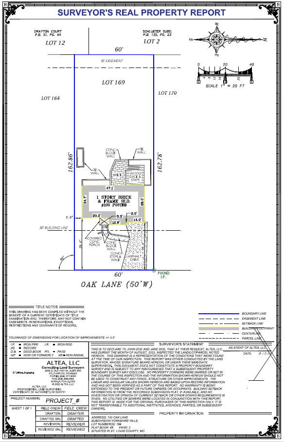

Surveyor’s Real Property Report (SRPR, “Spot” Survey)
-
A Surveyor’s Real Property Report (Spot Survey) identifies only some of a property’s corners, and supporting monumentation sufficient to draw the general boundary lines. This survey does include improvements such as the house or any concrete, etc., but it will not show fences. Spot Surveys are not required to be as mathematically accurate as Boundary Surveys, and therefor can be off by a few inches, or in some cases, a few feet. Because of this, any encroachments found during the process, will be labeled “potential encroachments” to note that the encroaching amount may vary. A Spot Survey will show any building setbacks and easements on the record plat, if applicable.
-
SRPRs can be used for real estate closings, but most title companies will not provide survey coverage (on the title insurance policy) upon receipt of a Spot Survey - check with your title company for confirmation. Most municipalities and counties will not accept a Spot Survey for permitting processes. This survey is most useful for understanding an approximate size of the land and the general idea of the boundary thereof. The SRPR has been historically used by lenders and investment entities to verify that a property exists and is roughly the shape or size described by a recorded document.